


Washington County (Central)--Hillsboro City PUMA, Oregon
About
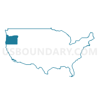
Outline
--Hillsboro+City+PUMA%2c+Oregon_A280.png)
Summary
| Unique Area Identifier | 193808 |
| Name | Washington County (Central)--Hillsboro City PUMA |
| State | Oregon |
| Area (square miles) | 81.66 |
| Land Area (square miles) | 81.63 |
| Water Area (square miles) | 0.03 |
| % of Land Area | 99.97 |
| % of Water Area | 0.03 |
| Latitude of the Internal Point | 45.45478580 |
| Longtitude of the Internal Point | -122.93150340 |
Maps
--Hillsboro+City+PUMA in Oregon.png)
Graphs
Select a template below for downloading or customizing gragh for Washington County (Central)--Hillsboro City PUMA, Oregon
--Hillsboro+City+PUMA%2c+Oregon_T0.png)
--Hillsboro+City+PUMA%2c+Oregon_T1.png)
--Hillsboro+City+PUMA%2c+Oregon_T2.png)
--Hillsboro+City+PUMA%2c+Oregon_T3.png)
--Hillsboro+City+PUMA%2c+Oregon_T4.png)
--Hillsboro+City+PUMA%2c+Oregon_T5.png)
--Hillsboro+City+PUMA%2c+Oregon_T6.png)
--Hillsboro+City+PUMA%2c+Oregon_T7.png)
--Hillsboro+City+PUMA%2c+Oregon.png)
Neighbors
Neighoring Public Use Microdata Area (by Name) Neighboring Public Use Microdata Area on the Map
- Washington County (Central)--Beaverton City (West) & Aloha PUMA, OR
- Washington County (Southeast)--Tigard, Tualatin & Sherwood Cities PUMA, OR
- Washington County (West)--Forest Grove, Cornelius Cities, Bethany & Oak Hills PUMA, OR
- Yamhill & Polk Counties PUMA, OR
Top 10 Neighboring County (by Population) Neighboring County on the Map
Top 10 Neighboring County Subdivision (by Population) Neighboring County Subdivision on the Map
- Beaverton-Hillsboro CCD, Washington County, OR (404,973)
- Rockcreek CCD, Washington County, OR (69,001)
- Newberg CCD, Yamhill County, OR (37,156)
- Forest Grove-Cornelius CCD, Washington County, OR (37,133)
- Chehalem Mountains CCD, Washington County, OR (5,486)
- North Plains CCD, Washington County, OR (4,800)
Top 10 Neighboring Place (by Population) Neighboring Place on the Map
Top 10 Neighboring Unified School District (by Population) Neighboring Unified School District on the Map
- Beaverton School District 48J, OR (255,082)
- Hillsboro School District 1J, OR (125,462)
- Tigard-Tualatin School District 23J, OR (78,274)
- Newberg School District 29J, OR (33,940)
- Sherwood School District 88J, OR (29,224)
Top 10 Neighboring State Legislative District Lower Chamber (by Population) Neighboring State Legislative District Lower Chamber on the Map
- State House District 26, OR (76,186)
- State House District 30, OR (74,832)
- State House District 24, OR (66,002)
- State House District 29, OR (65,597)
- State House District 34, OR (65,504)
- State House District 25, OR (65,088)
- State House District 28, OR (64,020)
Top 10 Neighboring State Legislative District Upper Chamber (by Population) Neighboring State Legislative District Upper Chamber on the Map
- State Senate District 17, OR (145,013)
- State Senate District 13, OR (141,274)
- State Senate District 15, OR (140,429)
- State Senate District 12, OR (128,429)
- State Senate District 14, OR (126,140)
Top 10 Neighboring 111th Congressional District (by Population) Neighboring 111th Congressional District on the Map
Top 10 Neighboring Census Tract (by Population) Neighboring Census Tract on the Map
- Census Tract 321.03, Washington County, OR (10,190)
- Census Tract 324.06, Washington County, OR (8,505)
- Census Tract 316.09, Washington County, OR (8,468)
- Census Tract 317.04, Washington County, OR (8,379)
- Census Tract 322, Washington County, OR (7,645)
- Census Tract 329.02, Washington County, OR (7,568)
- Census Tract 316.10, Washington County, OR (7,458)
- Census Tract 324.04, Washington County, OR (7,260)
- Census Tract 326.03, Washington County, OR (7,144)
- Census Tract 319.08, Washington County, OR (6,896)
Top 10 Neighboring 5-Digit ZIP Code Tabulation Area (by Population) Neighboring 5-Digit ZIP Code Tabulation Area on the Map
- 97007, OR (66,954)
- 97006, OR (63,036)
- 97229, OR (58,217)
- 97124, OR (48,349)
- 97123, OR (44,537)
- 97224, OR (31,122)
- 97132, OR (28,278)
- 97140, OR (23,474)
- 97113, OR (14,155)
- 97133, OR (4,000)